How is multispectral imagery used in agriculture?
Multispectral imaging is used to detect subtle variations in plant health before visible symptoms appear. Before stressed plants show visible symptoms, they will have a small reduction in chlorophyll content. Using our multispectral sensors we will be able to detect this before it has a large impact on the crops. Early detection of diseases or pests is the best way to prevent a larger issue.
Ontario Drone Surveys uses many different indexes to measure the health of your crops such as NDVI, GNDVI, LCI, NDRE, and OSAVI. Using these indexes we can very accurately measure the health of your crops to find potential health problems within the plants, or pests before they negatively impact yields and profits.
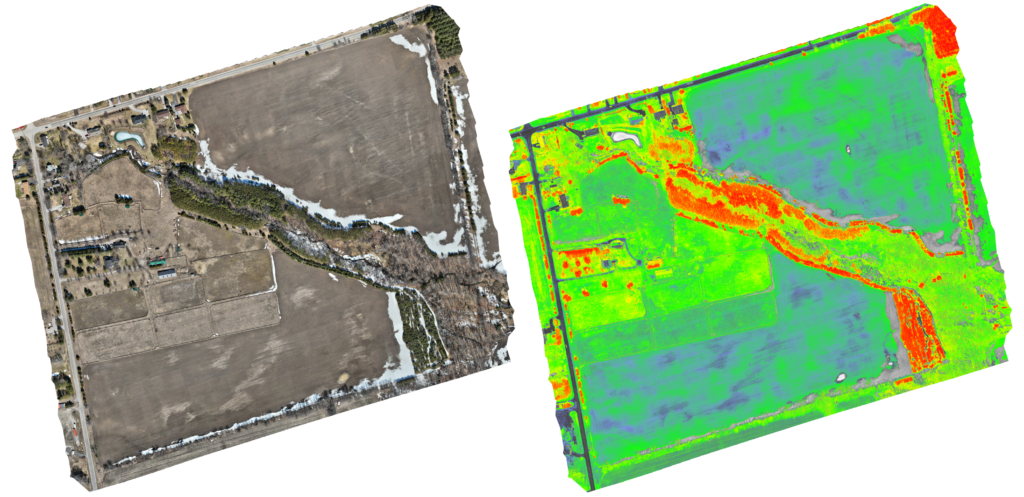
The above photos demonstrate the difference between a normal (RGB) survey and a multispectral survey using the Landsat Normalized Difference Vegetation Index (NDVI). At this farm, the photos were taken in late March when most vegetation is still dead from the winter. The red on this map indicates rapid photosynthesis and growth, yellow indicates slow growth/stress, green indicates slow growth/dying, and blue/grey indicates dead matter. This survey was conducted in late March, so there is very little growth in the fields, and the red portions of the map are almost exclusively evergreens.
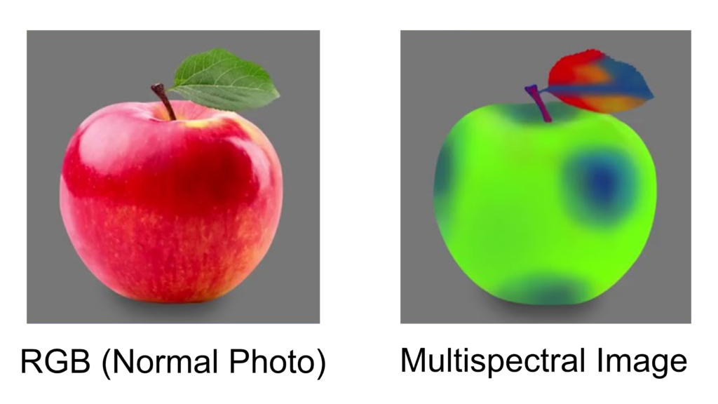
Multispectral indexes are calculated by formulas using different spectrums of light that are not visible to the human eye. There are some light spectrums that a healthy plant should be absorbing, and some it should be rejecting. We can use the data collected by the sensors or our drones to create these maps.
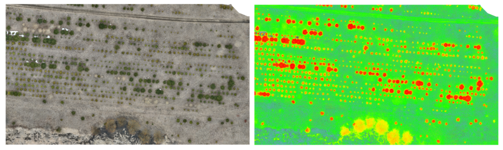
Above is a small portion of a reforestation project. The purpose of this survey was to get an updated look at the progress of the evergreens